Masaya
 |
 |
It is believed that the Niquiranos were the first people to dwell in the land of Masaya (the Chorotegas had also inhabited these areas). There is evidence of their settlements in small towns like Nindiri, Niquinohomo and Monimbó from before the Spanish Conquest. One of the city's principle neighborhoods is Monimbó (which in Spanish means "close to the water") and is located very close to the lagoon. There is documented evidence that in the 6th century, Monimbó had a population of about 150 tributaries.
Pedrarias Davila initiated the conquest of what is now Masaya in 1524 and created the first encomiendas. Since Masaya is located on the main road from Granada to León, as well as the road to Panama, it soon developed into an appropriate resting place for travelers. Due to its nice climate and fertile soil, many people were drawn to settling in the city, thus creating the colonial city of Masaya.
On 24 March 1819, the King, Ferdinand VII of Spain, granted Masaya the title of "Very Noble and Loyal Village Faithful to San Fernando of Masaya" that you can still read on the city's coat of arms today. Additionally, the city's coat of arms says, "Long Live the Heart of Mary". On 2 September 1839, Masaya was officially declared a city.
Of all the different indigenous settlements, only Monimbó has conserved its ethnic identity over time.
On 19 September 1912, during the Nicaraguan civil war of 1912, Nicaraguan rebel forces opened fire on American Marines and sailors passing through the city on their way to Granada. This became known as the Battle of Masaya.
Map - Masaya
Map
Country - Nicaragua
 |
 |
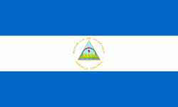
| Flag of Nicaragua | |
Originally inhabited by various indigenous cultures since ancient times, the region was conquered by the Spanish Empire in the 16th century. Nicaragua gained independence from Spain in 1821. The Mosquito Coast followed a different historical path, being colonized by the English in the 17th century and later coming under British rule. It became an autonomous territory of Nicaragua in 1860 and its northernmost part was transferred to Honduras in 1960. Since its independence, Nicaragua has undergone periods of political unrest, dictatorship, occupation and fiscal crisis, including the Nicaraguan Revolution of the 1960s and 1970s and the Contra War of the 1980s.
Currency / Language
| ISO | Currency | Symbol | Significant figures |
|---|---|---|---|
| NIO | Nicaraguan córdoba | C$ | 2 |
| ISO | Language |
|---|---|
| EN | English language |
| ES | Spanish language |


